Part 6. Australia, Detour to Ayers Rock
============================
Wednesday, 14 December, 2011
----------------------------------------
Up at 04:00, out to the airport. Already about 70oF.
I lost a corkscrew at the airport when they decided it was a deadly weapon. It had gone through other airports in my backpack up until then. Sometimes, I think they do stuff like that on a whim.
We flew to Sydney on Virgin Airlines, where they don't even give you water. You have to buy everything. Our connection to Qantas went smoothly, and we got a small meal on the flight.
There is a 1 ½-hour time change at Uluru. Why the half hour? Nobody knows.
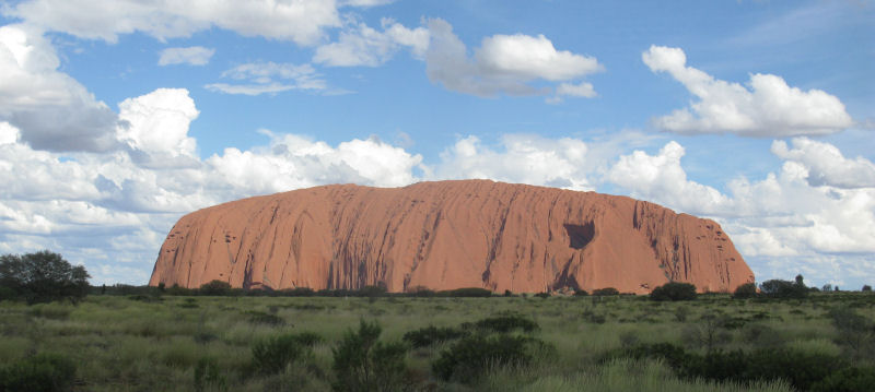
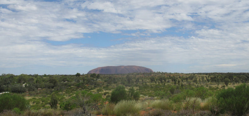
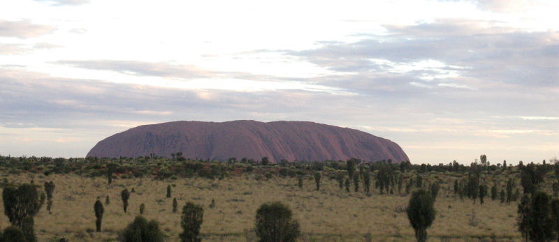
We caught sight of the Rock as we neared the airport.
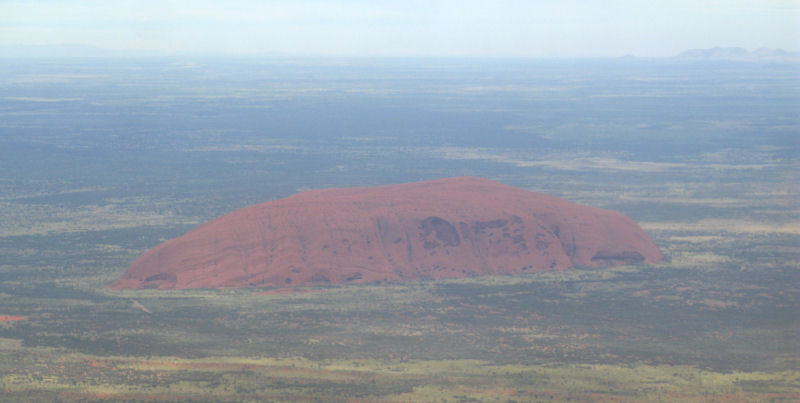
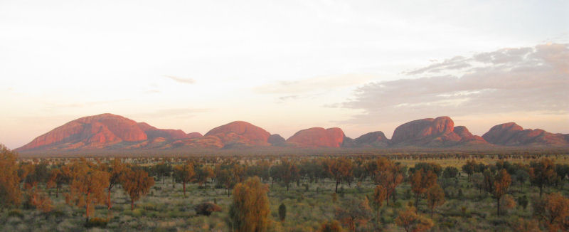
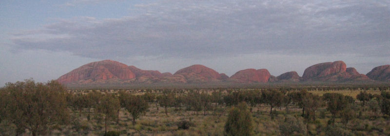
Uluru (better known to most as Ayers Rock) and nearby Kata Tjuta are small bits of much larger rock layers that project up above the surrounding terrain. These formations go several kilometers deep into the ground. The Kata Tjuta formation (also known as The Olgas) is much more dramatic, but somehow Ayers Rock got all the publicity.
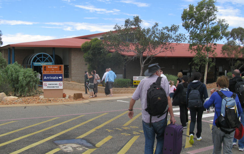
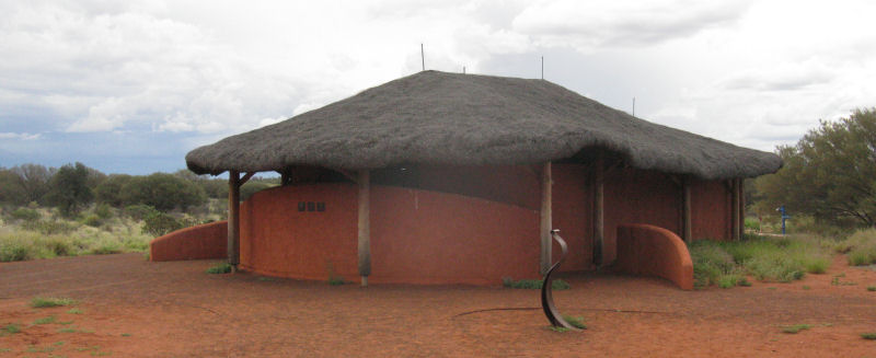
The airport was small, and we caught the shuttle bus to our hotel. The entire resort area in located in a well-designed community, so everything is on the same large circle road.
After getting settled, we took a short hike to the nearest lookout point--which was simply the only sand dune within the circle road.
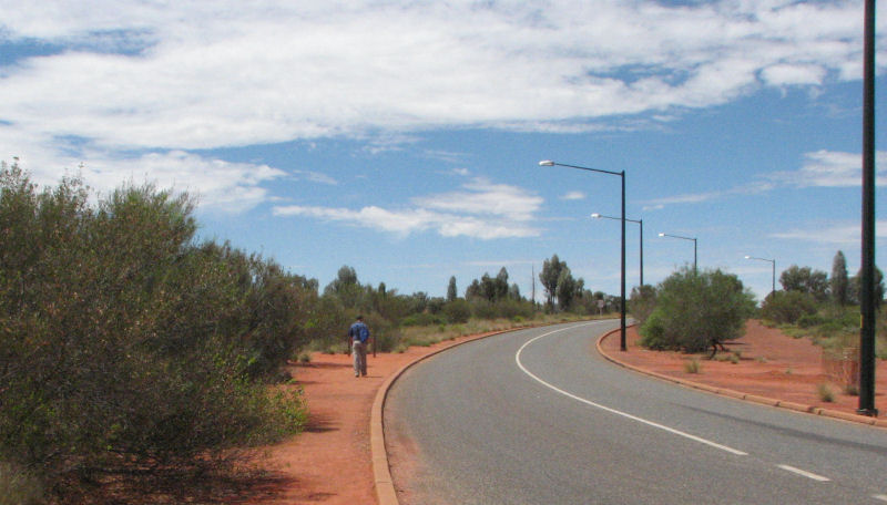

That's the lookout point. Not much, but it was all there was in the flat landscape.
We could see Uluru and Kata Tjuta, so it was worth the walk.
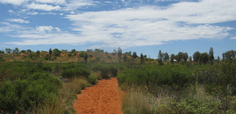
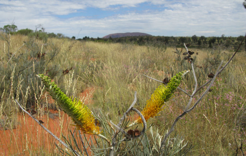
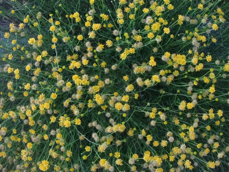
The last two seasons have been wetter than usual, and the last couple of weeks have seen a lot of rain. Almost all the greenery seen (aside from the bigger trees and bushes) have grown within the last two weeks. The locals were constantly commenting on how green everything was, and how we had picked a good time to visit. Normally, everything would be red dirt with a few scrubby bushes and trees.
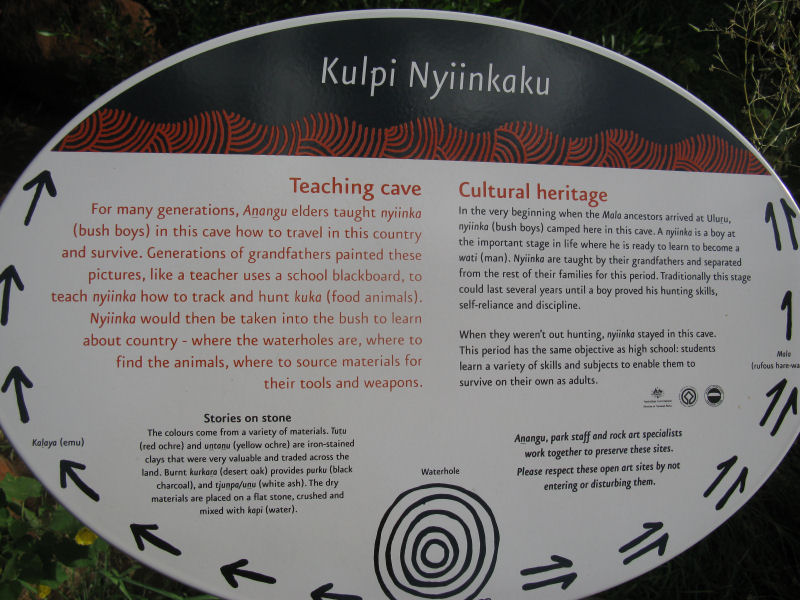
There were lots of educational displays and signs in the area, so you couldn't help but learn a lot about the aboriginal Anangu people and culture. Evidence showing their drawings and artifacts have been dated back to more than 50,000 years ago, making them one of the oldest societies--if not the oldest--on Earth.
We walked across the circle road to the shopping area and walked through the visitor's center, which focused mostly on the animal life and geological history of the region. Anangu and scientific explanations of Uluru and Kata Tjuta were presented side-by-side. Back at the hotel, we had a kangaroo-meat snack at the little cafe that was open.
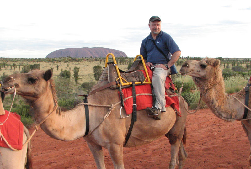
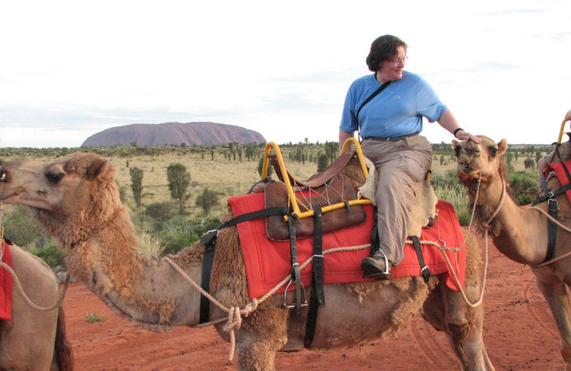
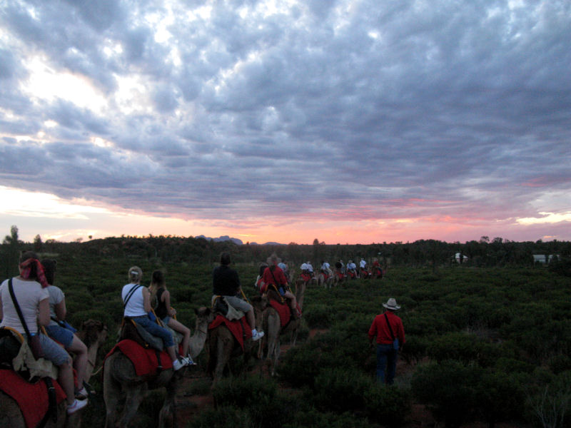
Our travel package included a camel ride this evening, but we didn't know what to expect of it. It wasn't going to last long enough to get all the way out to Uluru, but it was slated as a sunset ride, so it should be scenic.
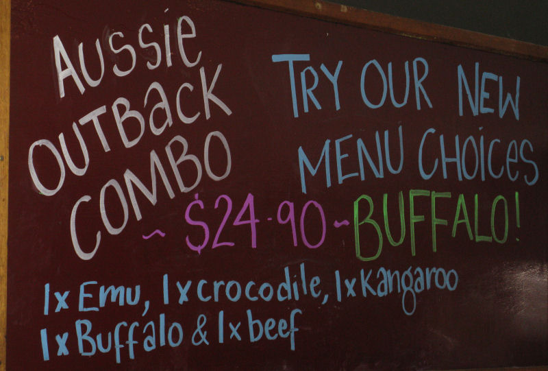
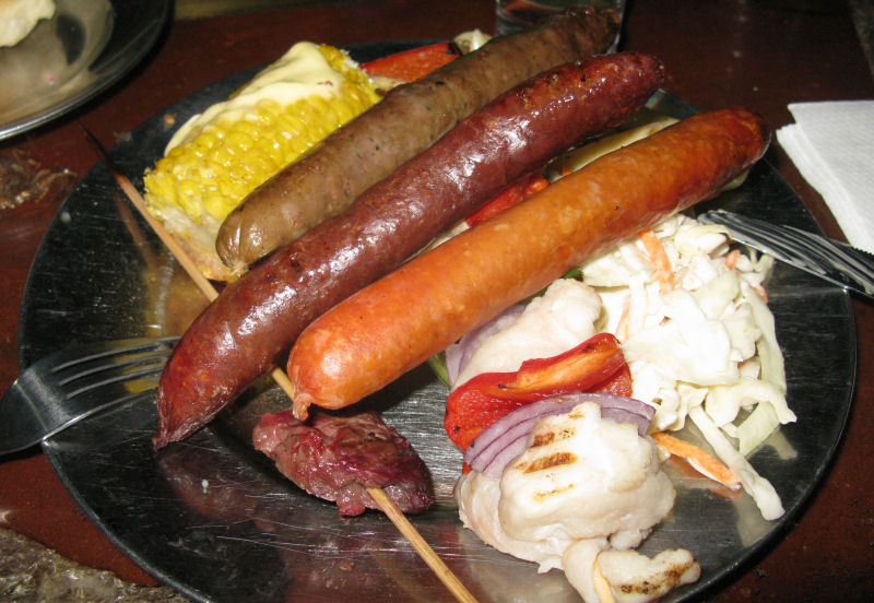
Each evening, our hotel had a cook-your-own BBQ. Lots of various steaks and other meats available, but the combo was the "tourist special."
In the meantime, I settled in at our hotel's large patio to kill some time and some beers.
There was a large floor-standing fan nearby, and it was also misting water into the airstream. I re-directed the fan to point directly at my table, and it felt great. Two young women in bikinis walking back from the pool passed in front of the fan and froze when the cool air hit them. They went, "ooh," and, "aah," and luxuriated in the air flow. When I laughed, they told me that the fan was excellent. I replied that two pretty, nearly naked girls in front of a powerful fan was also excellent. They laughed and went on their way after a final cavort.
Signs around the patio explained that the region was legally dry--meaning no alcohol was allowed. The resort and the hotels had been granted exceptions, of course. The local aborigines were prohibited from buying or possessing "grog," and a letter from local authorities explained the issues for the tourists. Like other indigenous peoples, the Anangu had no tolerance for alcohol in their genetics. The letter explained, without accusation, that since the arrival of grog with the "WhiteFellas," many "BlackFellas" have had a hard time due to alcoholism.
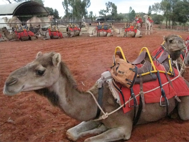
The bus for the camel ride made the loop, picking up their customers from the various hotels and taking us out to the stables.
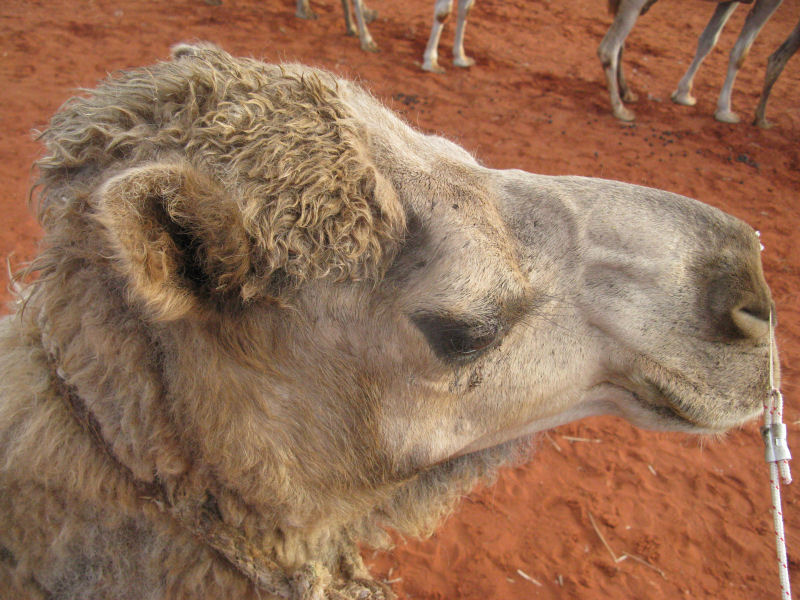
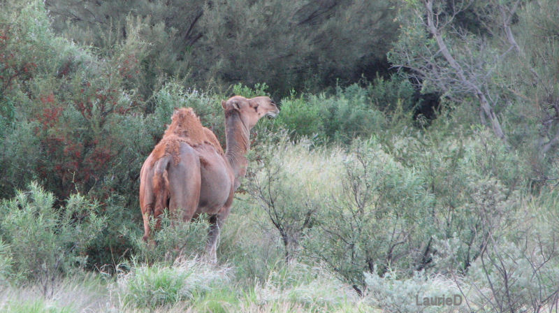
Camels had been introduced to Australia long ago, and they had flourished fantastically. Every decade, they issue licenses for the killing of about half the wild population, but the camels double in number in that same time so the effect is stabilizing. Most of the camels at the stables had been born there, but I think a few had been captured in the wild while young. The beasts were definitely used to the routine, and they were quite well-behaved. No spitting or biting, as some anecdotes had suggested. I decided that if the didn't bite or spit on me, I wouldn't bite or spit on them.
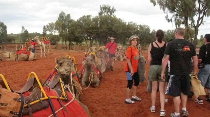
We had more than twenty people in our group, and most got paired up on their camels. Laurie and I were near the back of the line, and we lucked out with our own camels each. My mount was introduced to me as Wombat, and I was told that he was a bit of a grump.
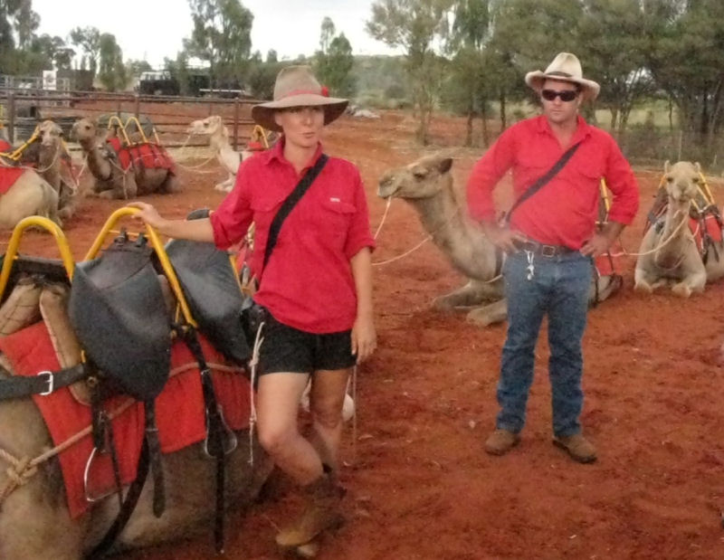
We were instructed on mount and dismount techniques by the prettiest guide of the bunch (a wise choice).
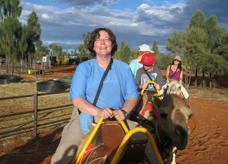
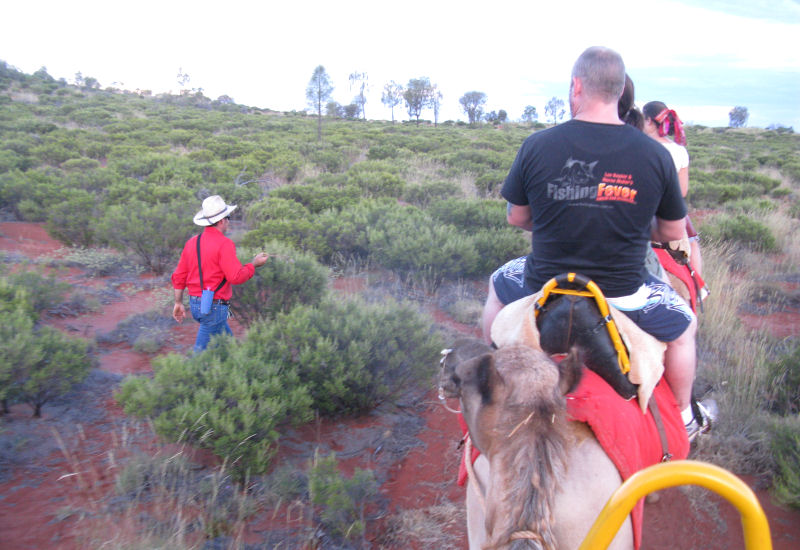
We split up into two camel-train groups, with a guide leading each group and another guide who walked alongside the entire time. So, that's how fast we went along--a walking pace.
After we had all mounted up, the first group took off and our group followed soon after. Everyone was required to carry water, and they supplied a sling to hold a bottle each.
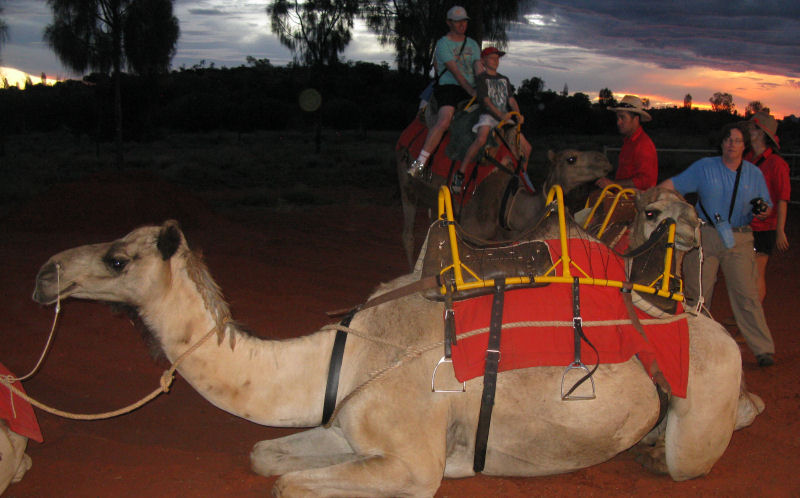
The camels are tethered close together, so the head of each camel was pretty much right at the rump of the preceding one. So, when stopped, each rider had the following camel's head right at their side as the animals tended to bunch up.
Laurie's camel, Chester, liked to come up and lean on Wombat.
This was my view of Chester. They didn't mind a gentle scratch or rub on the head, but if you bothered them too much, they seemed to get irritated.
Our ride was pretty lazy. We made a big loop over the countryside, staying on well-established trails.
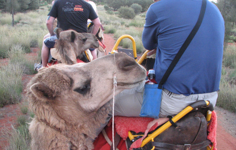
Aggressive ants would get on the camels' legs and cause them to stamp fairly often, but aside from the noise it never bothered the rider. At some stops, the walking guide would take your camera and photograph you if you wanted. An official tour photographer was also along at various times to take better photos, which they would sell to you on a CD-ROM later.
The walking guides answered questions and explained a lot of stuff--mostly related to the camels, but sometimes general info about the National park or the vegetation. Again, everything that is bright green has grown in the last couple of weeks.
We didn't get close to Uluru, but we had already signed up for other tours the next day.
The sunset was approaching as we started back toward the stables. It was actually darker than the next photo suggests.
We dismounted as instructed. You have to pay attention, because some of the camels, including Wombat, know when the ride is over and they plop down without waiting for instruction. The rapid front-back tossing motion can launch you if you're not ready.
Back at the stable shop, they served snacks and drinks, including soft drinks, beer, and champagne. The beer bread was a local recipe, and it was wonderful. I asked for and was given a copy of the recipe. Some of the ingredients, mainly the spices and herbs, would be hard to find in the States, but substitutions would be easy enough.
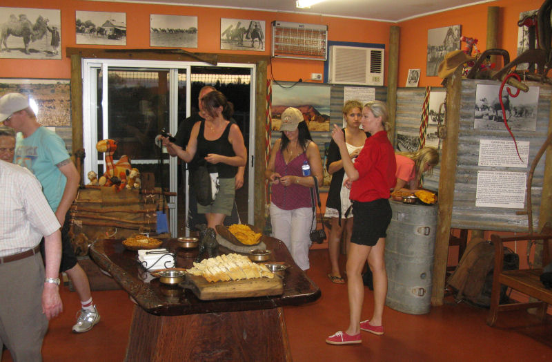
After everyone had snacked and bought souvenirs and photos, we loaded back onto the bus at about 18:30 and headed back for the resort area.
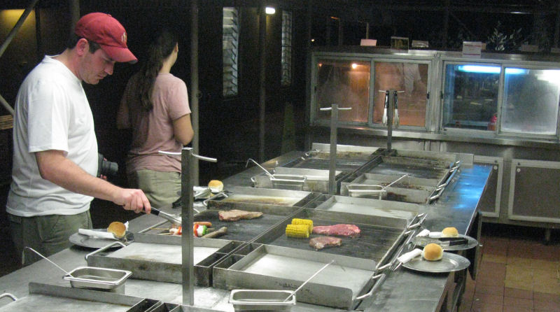
We ordered the tourist special combo and threw it on the grill. The salad bar was included, and it was all-you-can-eat. On the grill, the meats were, from top to bottom (and in alphabetical order), beef, buffalo, crocodile, emu, and kangaroo.
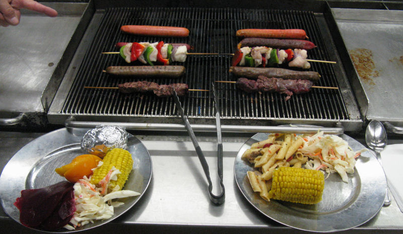
The different meats cooked at different speeds, so it took some experimenting. We never got the crocodile cooked right, and finally gave up on it. It was really tough regardless what we did. The emu was gamy, but I was very hungry.
Thursday, 15 December, 2011
-------------------------------------
We were up at 04:15 and ready for the bus soon after. Other buses came by the front of the hotel and picked up other people for a variety of tours. All you needed to do was watch for the bus from whatever tour you had signed up for. We spent the time finding the Southern Cross and other constellations. Orion was upside-down again.
It was far from cool--maybe mid-70's already. We had been advised to use sunscreen and have a hat. Rain gear was also suggested, given the recent weather patterns.
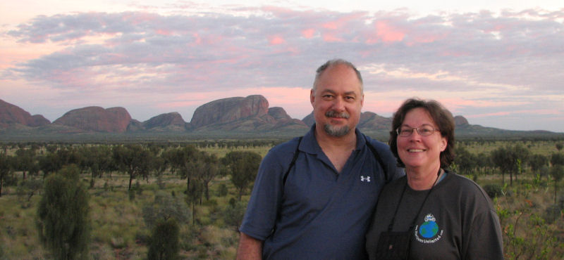
Our small tour bus picked us up right on time, and we had only one other couple for the trip to Kata Tjuta. Our lead tour guide was Pip, an experienced conservationalist and gardener. He knew every plant and its uses, which made for some nice conversation during the drive out to the rocks and while hiking. Also along for the tour was a guide-in-training, Kylie. She practiced some of the routine narration along the way.
We were the only people at the Kata Tjuta overlook in the pre-dawn hours, and we waited while the sun came up. The rocks got bright red when the sun hit them.
Pip (along with everyone else) was repeatedly telling us how green everything was now, compared to the normal appearance of the region.
Everything that was flowering was new.
We only spotted one wild camel, but we saw droppings and footprints indicating that many had recently passed this way.
Pip had been guiding long enough to know all the regular questions, so we weren't able to stump him. Kylie took notes, I noticed. Kata Tjuta is also known as The Olgas to most tourists, but there is an effort to use the native names more than the European-given names.
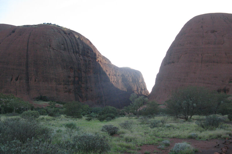
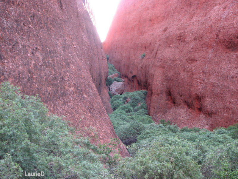
Our tour included the narrated drive, an hour or so of hiking up into the rock cleft seen below, and a light breakfast.
Kata Tjuta is just as much a sacred place to the aboriginal natives as Uluru (Ayers Rock), and most of the formation is a "man's place." Because they don't tell any of their secrets to the WhiteFellas, the exact location of the sacred spots is known only to the Anangu people. We were required to remain on the well-worn footpath.
The composition of Kata Tjuta and Uluru are very different, even though both were formed at the same time by the eroded bits from nearby mountains that are now long-gone. The larger bits settled first forming the rocky plain from which Kata Tjuta juts. The smaller sand washed farther along and formed another sedimentary plain, and Uluru is a projecting part of that.
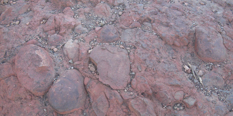
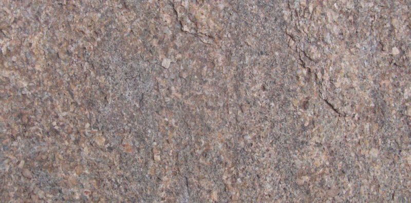
Hundreds of millions of years of pressure from other layers of earth and an inland sea pressed the sediments together and eventually formed huge rock layers. Kata Tjuta is entirely made of rock that looks like this up close. The larger bits are larger than my big fist.
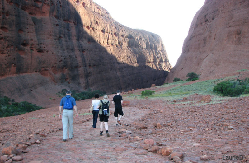
In his nearly shapeless hat, Pip led our trek into the rock cleft, identifying every tree and shrub, and how some of them were useful in bush survival. The water that collects here is what attracts the wild camels and kangaroos.
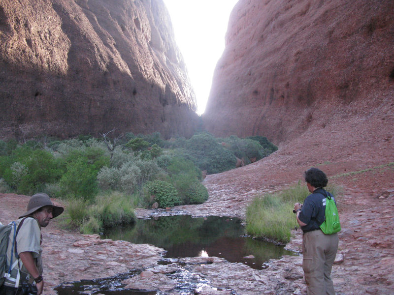
The hike ended at a deck that had been provided as a rest stop. All of the bushes in the cleft had grown since last month. Tourists were prohibited from going further here.
We met a few other hikers on the trail. With a park pass, you can drive, hike, or get around however you choose.
Back at the parking lot, we settled on a picnic table and ate cereal and toast, fruit, and coffee and tea.
The day was hot when the bus dropped us off at the hotel, so we took a nap.
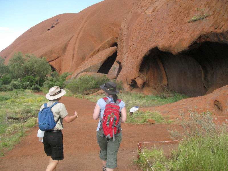
We had several others with us for the afternoon tour of Uluru. I can only think of a few reasons why Uluru is more well-known and popular with international tourists. It was discovered and named earlier (although they are within sight of each other), and the first photo of Uluru made it famous. It's a big rock, but it's small enough to walk around in several hours, and there are interesting Anangu sites all around it. Some are still sacred and off-limits--so much so that we were advised not to take photos of some sites. Laurie and I honored that request, so we have no photos of a few caves. You'll have to go there yourself.
Finally, for nearly a century most tourists came to Ayers Rock to climb it. More on that later. Climbing is prohibited on Kata Tjuta.
Our tour bus stopped at the spot where the first famous photo was taken, and we took our own obligatory shots. Linda (in the blue shirt), and Kylie again were along for this tour for training again. Paige was the lead guide and a great storyteller.
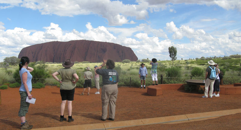
It took a while, but eventually the clouds cleared enough to get a bright shot.
The airfield at the rock is long gone, and the paved road around it stays away from the rock itself. Many of the features on the rock are not evident from a distance. Most of these features are explained in Anangu lore and legend, and Paige was great at relating many of these stories with great animation.
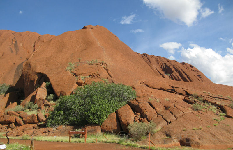
For those who choose to climb Uluru, this is the spot (next photo). There is a chain rail to follow. What is seen below is only the very beginning of the climb, and it takes hours to get to the top. Heat and dehydration zonk most tourists, and it's harder than it looks.
The Anangu people ask people not to climb their sacred rock, and within a few years, the National Park will end the climb altogether. Something else we learned on our tour was that the urine and feces that tourists leave on the rock have poisoned the main water hole at the base of the rock. E. Coli has killed off some of the life in the waterhole, and it's not safe for people to drink anymore. Once the climb has been eliminated, it is estimated that it will take at least five years for the water to perhaps become well again.
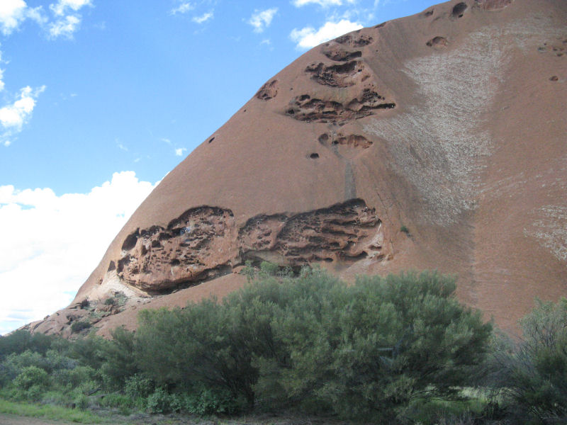
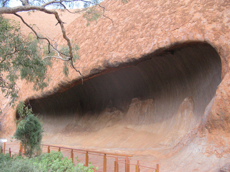
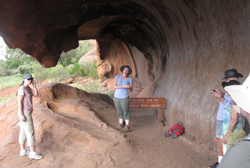
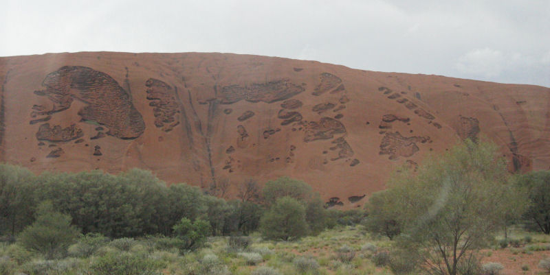
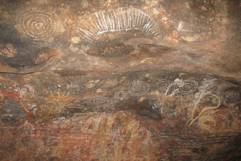
We walked more than a kilometer along the base of the rock, stopping at the well-marked points that were rich with ancient history. Some of these spots were simple living spaces, some were specific in their use.
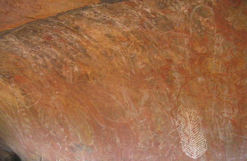
Used like a schoolroom blackboard, the rockface is sometimes covered and re-covered with drawings and diagrams. These are sometimes tens of thousands of years old.
Our walking route (and presumably, the entire walk around the rock) was on a defined course to protect the fragile environment. All along the walk, each significant site was marked and posted with educational signs.
How these caves were created was hard to imagine. The local lore and geological science were equally unlikely.
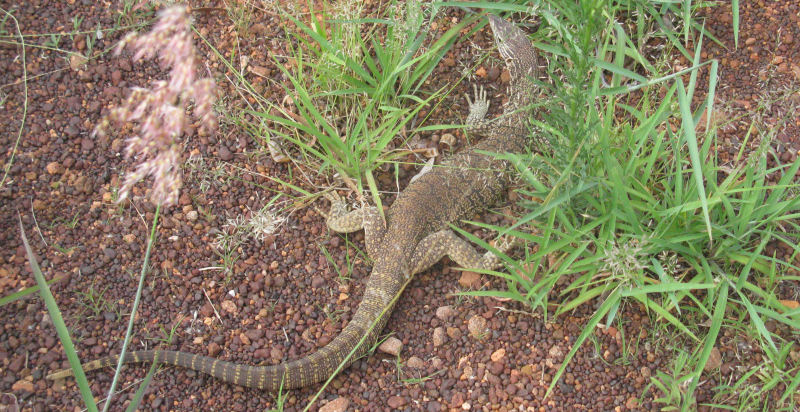
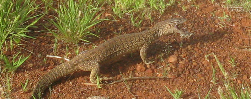
I noticed a large lizard (about two feet long) in the new grass right next to the walking trail. It didn't seem frightened by us at all.
Below, Paige shares some advice with Linda on handling tourists. I overheard some of it, but I don't think I was supposed to.
At one of the living spaces, Linda gave the explanations and told the stories.
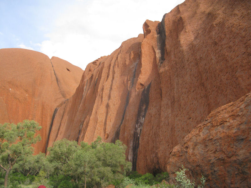
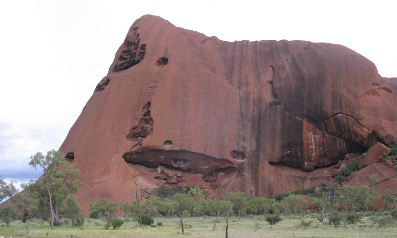
Here is a close-up of the rock of Uluru. Big difference from the nearby Kata Tjuta rock. The actual color of the sandstone is gray; it's iron oxidation that turns it red.
As we walked along, I pointed out to Paige that the lizard was pacing alongside us. She was amazed, and she took some photos of it herself. As we watched, the lizard came across a dead mouse and immediately snapped it up.
There are several places around the rock where water collects from rainfall and forms waterfalls. These spots are marked with black algae. At the base of these waterfall spots, the waterhole had tadpoles in it. That was a sign that the water was still good (so far).
At scheduled stops, Paige went a bit native on us and entertained us with wonderful renditions of Anangu legends.
One of the sites we were not allowed to photograph was called Mala Puta. Being an experienced guide, Paige was quick to let those who spoke a bit of Spanish know that the name meant "small kangaroo pouch" to the aboriginal people.
Weather started to look threatening, and it sprinkled on us as we got back to the van. Paige got us to a picnic area and a bathroom stop just in time for some of us.
We continued our drive around the rock, seeing features that I had never seen before. If you asked Paige about any of the features, she gave you the Anangu legend first, then a more mundane answer for those who needed it.
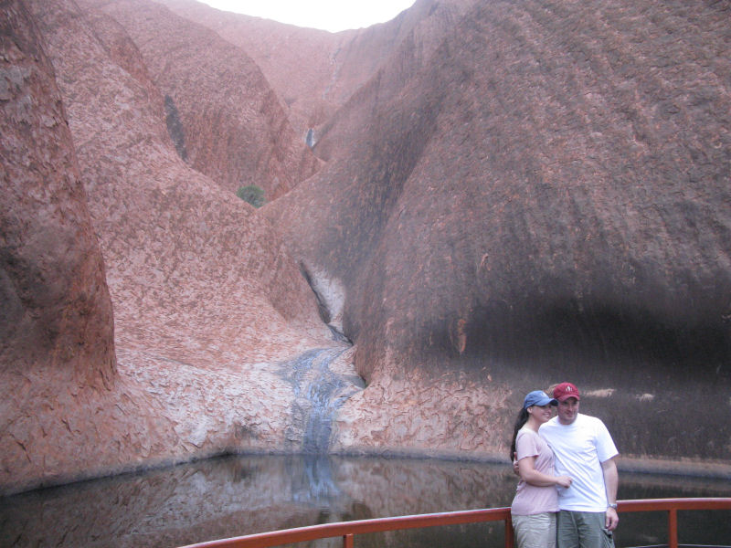
This was the largest and most permanent water hole at Uluru. It's also the one with E. Coli contamination. The climbing path passes high over this watershed area on the rock.
More ancient markings. Paige was able to explain some of them, but some were open to any interpretation.
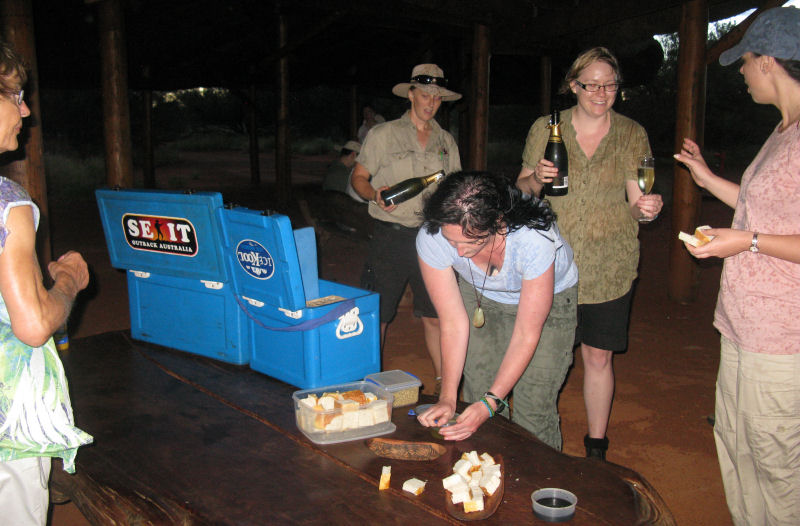
The clouds killed a scenic sunset, but lightning lit Uluru nicely now and then. We were happy to get out of the rain and have snacks and drinks in the picnic area. Champagne, mostly.
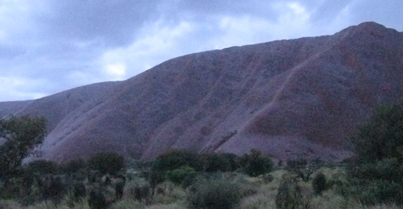
The rain got heavier as we snacked, and we became honored by being among the 2% of tourists who get to see rain on Uluru. As the water soaked the sandstone surface, it gave Uluru a silvery sheen. The photo doesn't do justice to how shiny the rock looked. And it was actually darker than the photo shows.
Back at the hotel, we opted for steaks this time around. I gave my grilling advice to this guy, who was wondering how to cook his tourist combo special. I hope he had better luck with his crocodile than I had.
Laurie did some email, buying an hour's worth of time on one of the hotel's computers. I hadn't been able to get this ride report updated for a while (not being willing to pay the fees), but I knew that it wouldn't really matter to anyone.
Friday, 16 December, 2011
----------------------------------
Slept late... blah blah blah... flew back to Brisbane (via Sydney)... blah blah blah...
<< PREVIOUS report -- Australia, Sydney to Brisbane >> << NEXT report -- Australia, Brisbane to Townsville >>
Australia, Detour to Ayers Rock
[ ERRANT-RONIN HOME ]
[ Prudhoe Bay to Ushuaia Home Page ]
[ Ride Reports Home Page ]