Pikes Peak KLR Ride, July 23, 2006
This report was originated on ADVRider.com, and is imported here with minor
editing for structure (due to the import process). Typos, etc., have
mostly been left as they are, fixed only for clarity in some cases. Some
characters have been identified by their user names on that website.
Martin is the report initiator and is identified here as SgtMarty.
-----
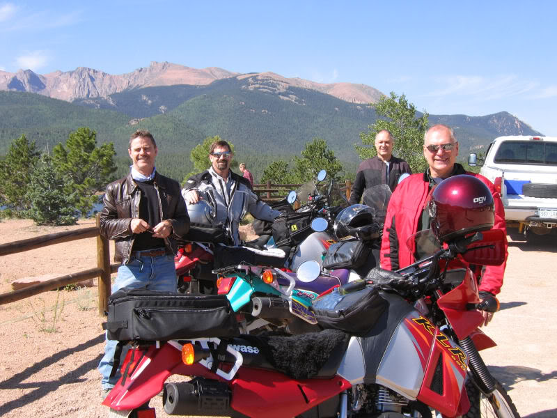
Okay, only the four of us KLR riders showed up today for Pikes Peak. What a
gorgeous day it was! I've never been on the Peak when it was so warm. Clear day,
mild breeze. Lots of tourist traffic and dusty, though.
We pose for the pre-ascent pic. Don, Kawioops, SgtMarty, Nick.
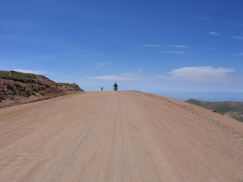
Since they are slowly widening and paving the road, it's different each time I
ride it. Here, they've widened the road enough to make it 3 lanes! The
challenging steep zig-zags are gone, and all the turns are now easier.
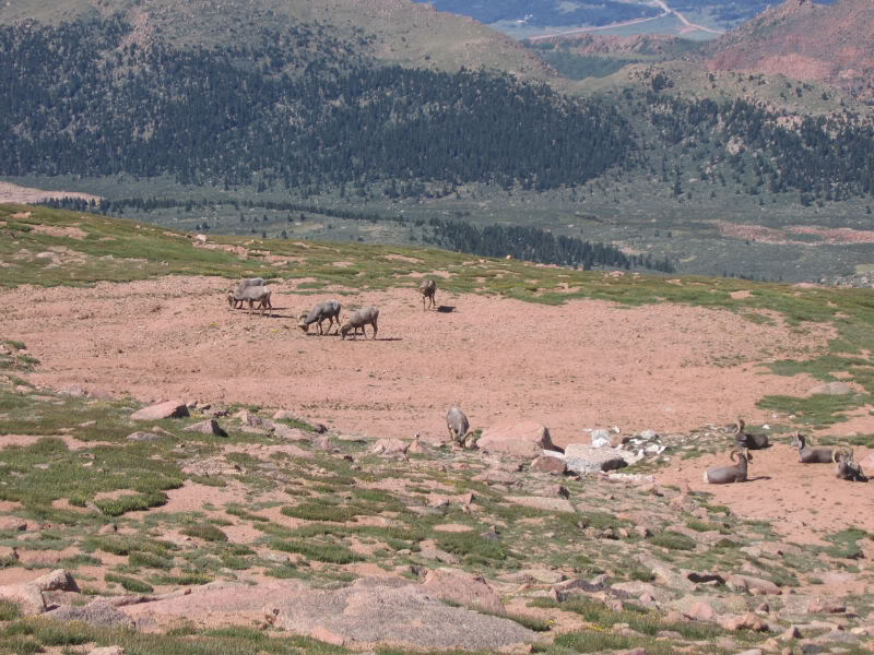
Stopped for a quick pic of bighorn sheep along side the road above timberline.
The necessary summit-pic-at-the-sign.
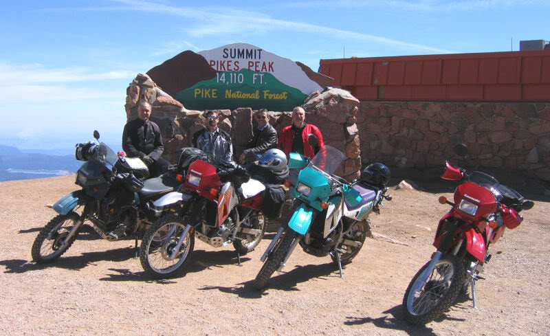
It was a very busy day on the Peak. The parking lot was full, as were the cog
trains.
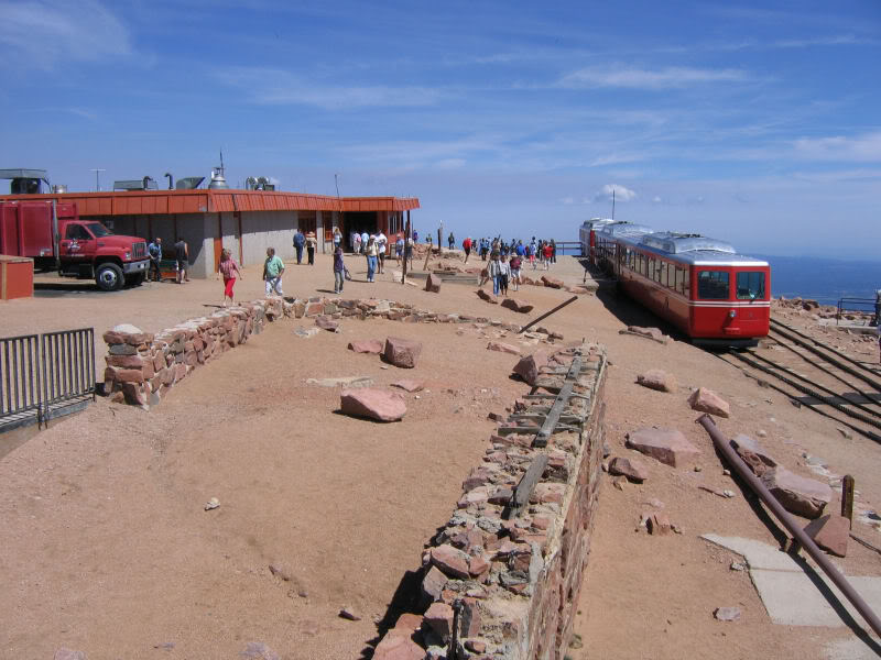
A tad hazy over Colorado Springs, but clear on the mountain.
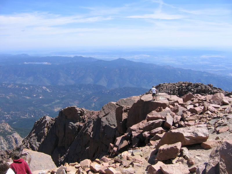
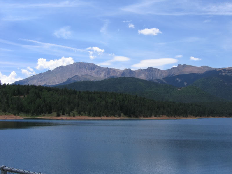
Stopped for more shots on the descent. This is a great pull-out spot for
dramatic shots of rocks and distant towns and reservoirs.
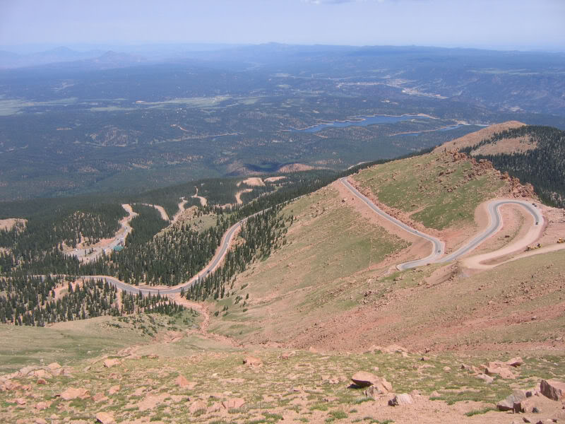
Each time I take this shot, the road is different. They actually put guard rails
(*gasp*) on some of the turns. Travesty.
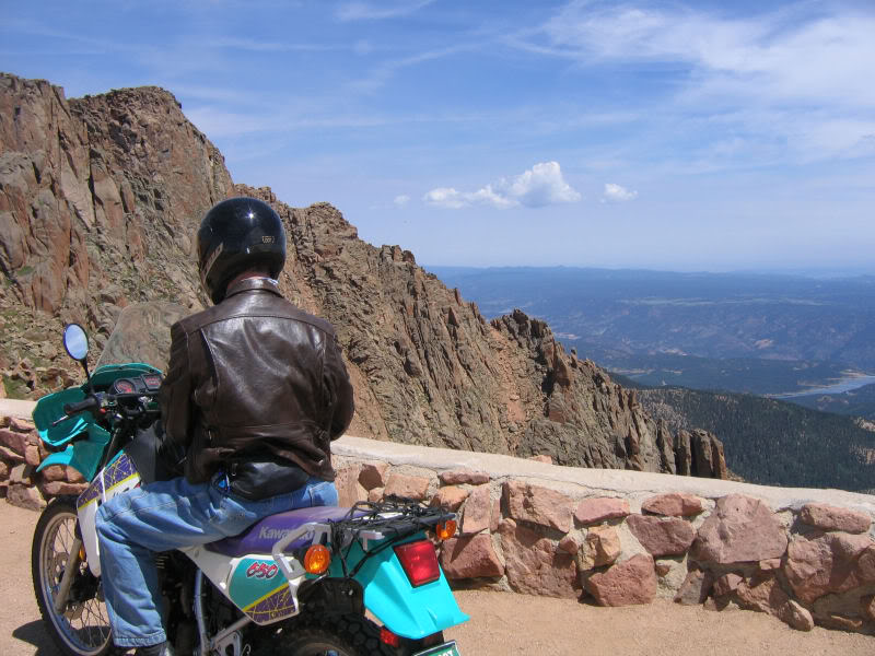
That thar is where we was, cuz.
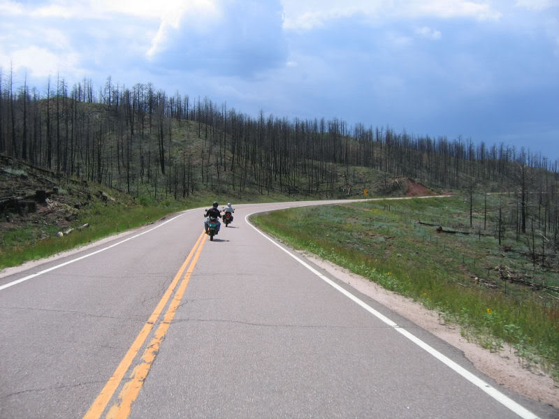
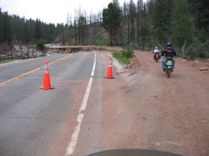
After lunch in Woodland Park, Nick headed home. Kawioops, Don and I went to see
the damage to highway 67 from the recent floods. First through the Hayman fire
area.
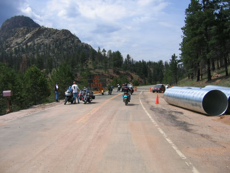
Kawioops had been through here just recently (yesterday?), so he knew we could
thumb our noses at the "road closed" signs and motor onward. Others were walking
in to see the road damage.
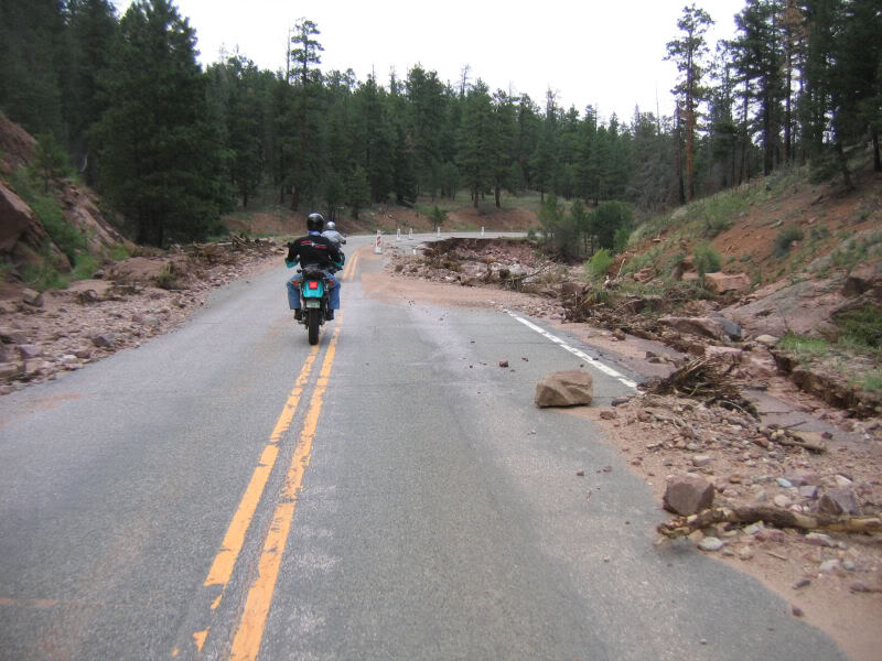
There were so many places where the floods (a couple weeks ago) had washed out
the road, that I stopped taking pictures. There were small areas of collapsed
road, and large areas. It went on for several miles.
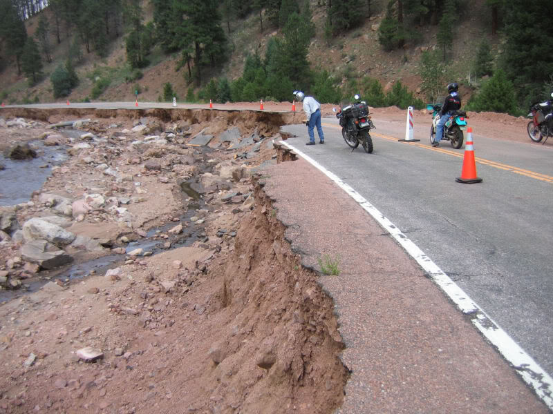
There were some construction detours that we took. The road may be "open" in a
month or so, but it won't be repaired for quite a while. No signs they have
started the repairs yet.
Still lots of debris on the road, too. Rocks and trees that hadn't been cleared
yet. At least one house had been carried away.
We rode dirt back up toward Sedalia, and split up there. I took Rampart Range
Road back south to Jackson Creek, then on to road 105 and home. Kawioops and Don
headed north.
A nice day for a ride, and a nice ride was had.
Dusty. Very dusty.
madmanxwater wrote: Nice report and pics! Seeing the four
KLR650s reminds me of six years ago when I had my 98 KLR, it was a great bike. I
put 30,000Klm on it in just under two years and had no problems at all, amaizing
considering I did all my own work on it! I'd like to have another KLR650 some
day as a "take more chances" kind of bike, things I don't think I would try on
my R1200GS.
Looks like you guys had a nice day.
Mike
CB650 wrote: Guardrails on the peak??????
 GAK! That's just lame. Real drivers don't need no steenkin guardrails.
Is there anyone up there to give you grief for going past the sign on 67? Do the
detours around the washouts let you go all the way through? I'm seriously
thinking about making a run up there this week to take a look at the damage and
within reason I'm notorious at thumbing my nose at idget signs.
P.S. Your Hayman fire picture was taken probably within 100ft of where I took a
picture of the burn a couple weeks ago. Cool.
SgtMarty wrote You can buy patches and pins at the top
that say "Real men don't need guardrails." Have them for women, too. They will
be irrelevent soon.
Yeah, we rode through the whole flood area and just kept going. No one was
around to say otherwise, but I suppose there might be workers there during the
week. I suspect they will plow out a roadway bypass to let traffic through
during the repairs.
CB650 wrote: Thanks. I'll have to see if I can sort out
enough time to fish the motorcycle out of hiding for a trip to the disaster
area.
I was at Glen Cove about a week ago. A friend of mine walked out of the shop
and handed me a smooshed penny. I'll have to go back for the patch now...

Roostn wrote: So, how long did it take you all to get to
the top? The last time I was up there a few weeks ago I made it up in 13 minutes
and 59 seconds. That included a detour at the top of the W's after stalling my
bike and running into the ditch, then I ran out of gas at Cog cut and blew the
corner while switching to reserve. It didn't make for a smooth pass but still a
respectable time. Anytime you make it to the top in the 13's you are going
FAST!!!
I however would not recommend trying a pass that fast during tourist season! The
cops have a tendency to frown on that!

SgtMarty wrote: Yeeks!
No, we rode at a mortal pace. It usually takes about 45 minutes from the
entrance gate to the top in tourist traffic. A tad longer coming down, since the
photos ops are better on the descent.
Did you do the race, then?
Roostn wrote: Yea, this was my 5th year of racing the
Hill Climb. Man, I really love it. Its not going to be here much longer so I
make sure I don't miss it.
Deano955 wrote: Wow, I had no idea that 67 was damaged
that badly.